
Real-time, Rear Projection Jack Skelington Mask
Wednesday, November 2nd, 2022
When my beautiful wife suggested we dress as as Jack Skelington and Sally from "The Nightmare Before Christmas" on Halloween, it inspired me to design a mask that would project an animation of Jack's face on the outside. And naturally the animation HAS to be real-time facial capture of the person wearing the mask! Unfortunately, I've only gotten as far as the live facial capture. Now I have to figure out how to pack an iPhone camera extender and my mini-projector inside a 3D printed mask!
![]()
What is Show Programming?
Tuesday, April 12th, 2022
Several people have asked me recently what a Show Programmer does for work. I've put together an article with a few demonstration videos. I haven't gotten all of them cleared yet, so the page will be temporarily password protected. Email me if you would like the login info.
This... is... SO COOL!!
Friday, January 28th, 2022
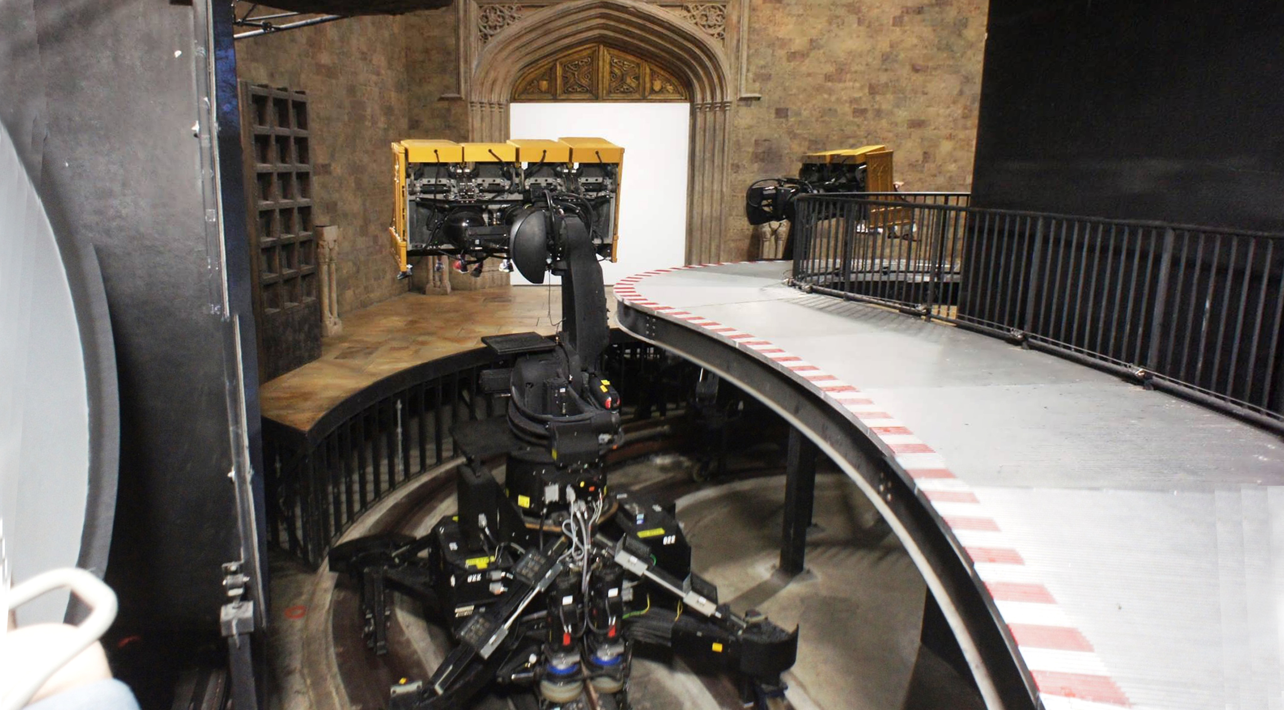
Just came back from another review of the BST-21 training simualator at the US Navy Recruit Training Command in Great Lakes, IL. Imagine a 12-hour long escape room, themed around a US Navy guided missile destroyer. During this over-night event, recruits are put to the test to show they not only learned from their basic training, but can apply those lessons under pressure. It's built like a theme park attraction, equipped with automated special effects equipment such as fire, floor, smoke, scent, and floor shakers. Sounds like fun! But this show is visceral as F@$#!
Disney Institute
Tuesday, August 10th, 2021
I just completed the last course of a leadership series through Disney Institute. The On-Demand Brilliance Collection actually has quite a lot of good content. In addition to good insight on leadership, it also speaks well toward leadership in an entertainment community.

Demo Reel Update!
Wednesday, March 9th, 2016
I finally stopped putting of compiling my portfolio into a 2 minute demo reel. Still long by some standards, but the tune is catchy and I have plenty to show off.
Virtual Washington, DC
Monday, February 29th, 2016
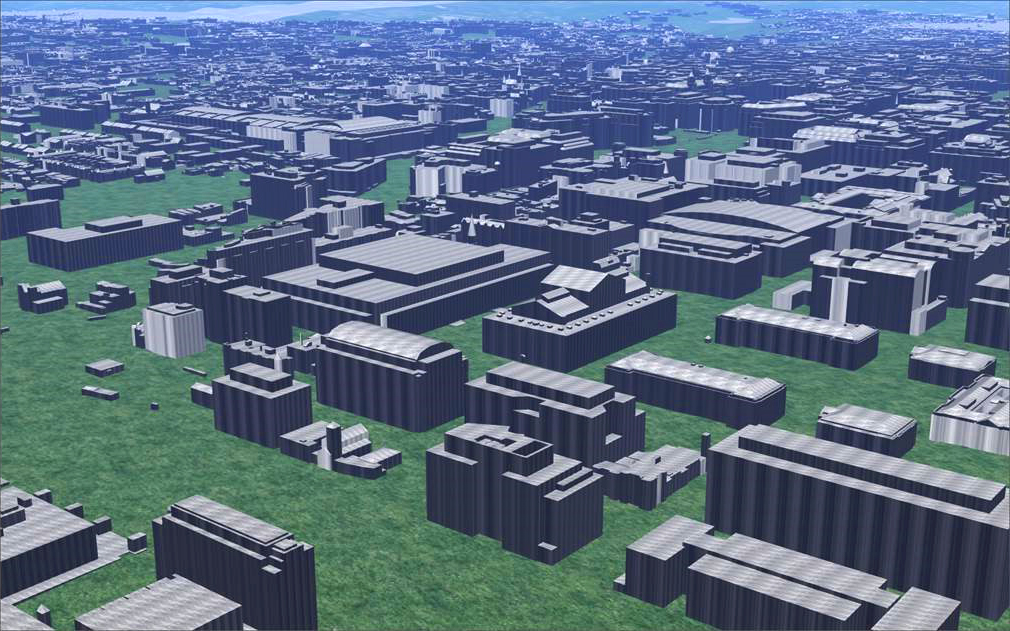
There are over 1700 buildings and a couple of hundred miles of road in the Distric of Columbia, so I have no illusions that I'd be capable of modeling all of that myself. But it makes a perfect test bed for large-scale geospecific procedural modeling, and the DC Open Data Catalog will make it feasible that I can finish the project by year's end.
Website Complete!
Friday, September 11th, 2015
I finally have content filled in for all of the sections of this website. So there shouldn't be any broken links or orphaned pages. If you find any let me know. And check back often as I will continue to refine the look and content of the site.

Virtual Virginia Tech!
Monday, August 17th, 2015
Back in the 90's I began building Quake levels and mods based on college campuses at which I had taken classes. But the graphics never reached the level of quality I was always seeking. So now that I have the tools, skills and experience to develop truly convincing and immersive environments, I'm experimenting with alternative tools to develop better versions of these campuses. To begin with, this version of Virginia Tech is being developed in Terra Vista 2014, using ArcGIS 10.3 to edit the GIS data I've downloaded from the city of Blacksburg website. Next, I'll be working on University of Florida campus using TrianGraphics, and then University of Central Florida using CityEngine.

New Website!
Friday, August 14th, 2015
I've resurrected my old website and will be adding to it as often as I can to fill out my work history and portfolio. If there is a reference to content that isn't available yet on the site, be sure to check back soon as I am adding to the site almost daily.
Home-made GPS device: Field Test Results.
Sunday, March 2nd, 2015
Title: Field Test Results.
The field test was a partial success. I was able to track our movement through the park during a family trip to Sea World. Fortune smiled again since we had to come back to the house, giving me an opportunity to reassemble the device with a new 9V battery and a button that would toggle recording of the data. I wanted to be able to start and stop recording so that I wouldn't record the road trip to the park and the road trip back. I only wanted to record from the parking lot of SeaWorld, through the park, and then back to the parking lot. Also I wanted to be able to stop and start the device when we sat down for lunch so that I wouldn't waste the battery or bloat the serial output. But the only way I would be able to control recording would be to detach the battery and then plug it back in to restart. I wasn't sure how unplugging and replugging the battery power supply would effect the function of the device, so instead I quickly added a button that would toggle the recording code. This was a big risk to add new functionality like this, and cost me the ability to use the LCD. It stopped working once I changed the code to include the button. I'm still not really sure why, but I could at least tell that the device was doing something because the LED on the Arduino was blinking.
TEST PLAN:
The test plan was to start the device at car with it plugged into my laptop to make sure it was working. Then walk through the park with the device secured in my diaper backpack, switching it off when we sat for lunch, start it up again for the return trip to the car. At the end of the trip, I intended to walk a pattern in the parking lot to see just how accurate the device was.
POST-PROCESSING:
It only took a bit of effort to make the image below. I opened the resulting text file on the SD card in Excel, using the import delineation parameters to separate all the coordinate attributes. Once I had the coordinates and time code, it was a simple matter to create a formula in Excel that would fill an XML file with coordinate tags to create a KML file that would load into Google Earth. Oddly enough, the KML file crashes Google Earth if you try to load it. I'm not sure why. There might be a byte alignment issue or some critical tag that I left out. Either way, it didn't matter. I was able to load the KML file into ArcGIS, which is what I had intended in the first place. The underlying Basemap you see above is part of the global street map data that comes standard with ArcGIS for Desktop, which I use at work.